


Contact Info
- Phone 1:
- 406-821-3269
Basics
- Number of Sites:
- 1
Amenities
Basic Amenities
- RV Sites
- Vault Toilets
Special Features
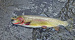
- Fishing
Details
Season
Open through Wed Oct 30 2013Location
Getting There:GPS Info. (Latitude, Longitude):
45.74611, -114.44333
45°44'46"N, 114°26'36"W
From Darby, travel south on Highway 93 for about four miles. Turn onto Highway 473 and continue southwest for 14 miles. Turn west onto Forest Road 468 and continue about 12 miles to the campground.
Basic Info
- Total Sites:
- 1
A variety of trails and unimproved roads are great for hiking and horseback riding. Three trails originate near the campground, including the Watchtower Trail and Sheephead Creek Trail which access the Selway-Bitterroot Wilderness and can be hiked as a loop. A steep, 2-mile trail leads to the historic Bare Cone Lookout.


