


Contact Info
8975 Highway 2 East
P.O. Box 190340
Hungry Horse, MT 59919
- Phone:
- 406-387-3800
Basics
- Season:
- May to November
Basic Directions
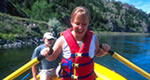
The primary access is by horseback and backpack. About 890 miles of trail navigate you around the “Bob”, as it is affectionately called by locals. The headwaters can be accessed by trailheads near the communities of Seeley Lake to the west or from the south near Ovando. Those coming in from the north will have to endure a 55 mile drive on graveled roads to the Spotted Bear Ranger Station. Another option is to pack in a raft (or have an outfitter pack one in) to Big Prairie, which is a large, picturesque prairie graced with century-old ponderosa pines. Float trips usually last 3-4 days, taking time out to explore the surrounding country. The take out is above Meadow Creek Gorge; the gorge being impassable to rafts.
Description
There are few places where an angler can experience fishing as it was at the turn of the century. The South Fork Flathead River is unique in that, with few exceptions, it supports an intact native fish assemblage. So forget those imported browns and rainbows, and come prepared to battle a native Montanan, the westslope cutthroat trout, in the solitude of the Bob Marshall Wilderness. The pristine setting, special fishing regulations and native fish combine to make the South Fork an increasingly rare resource in the west.
The South Fork originates at the confluence of Danaher and Youngs creeks and flows north for 57 miles into Hungry Horse Reservoir. The construction of Hungry Horse Dam in 1952 isolated migratory fish populations from the Flathead River and Lake. The upper 50 miles of the South Fork, from the headwaters to the Spotted Bear River, is classified as a Wild River under the 1976 Wild and Scenic Rivers Act. It is here that the best fishing is found, but expect to work for it. The virtues of wilderness demand work.
Before you go, please be cognizant of the rare resources the "Bob has to offer up from its bounty. This is grizzly bear country- hanging your food in a tree or using bear proof containers is a requirement (A food storage order is in effect), and don’t leave fish entrails along the shore. If using pack animals, certified weed free hay is required, and always practice Leave-No-Trace camping. Cherish and respect these resources, so future generations can experience the same opportunities that make memories.
Fishing
Fish:
Cutthroat Trout
Whitefish
Details
Season:
Additional Details:
Rivers and streams open the third Saturday in May through November 30. Lakes are open year round. Special regulations have been enacted on the South Fork above the dam since 1982. Wilderness limits apply in the South Fork which is 3 fish daily and in possession. Rivers and streams have an additional regulation that no fish can be over 12”. The only complaint, if one can call it that, is that you can’t find any fish under 12” for the frying pan. How can one be so unlucky? Anglers should check the regulations and note that catch-and-release fishing with artificial lures only applies from the Meadow Creek Bridge to the Spotted Bear footbridge.
A side note here about bull trout: Bull trout populations appear stable in the South Fork while declining in most other places across their range. Bull trout were listed as a “threatened” species under the Endangered Species Act in 1998 by the U.S. Fish and Wildlife Service. Managers hoped to protect this population prior to listing, so an emergency closure was placed on bull trout within the South Fork in 1993. Managers are working on solutions with diverse interest groups to recover bull trout across their range.
The South Fork below Meadow Creek Gorge downstream to the reservoir offers good fishing for the roadside angler with short hikes to the water. The Cedar Creek Access is a good but steep place to pack a raft down to the river. Angling pressure is higher here than in the wilderness, but for those with limited time, this stretch offers a good alternative.


